-
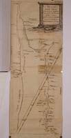 [Untitled]
 A hand-drawn map for publication. Includes Suez at the top and Yambo at the bottom. Emphasis on ports and coastal spaces with suggestion of hills and mountains.
Map designed to be folded.
-
 [Untitled]
-
 [Untitled]
-
 [Untitled]
-
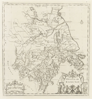 [Untitled]
-
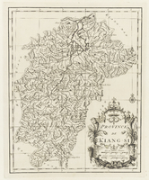 [Untitled]
-
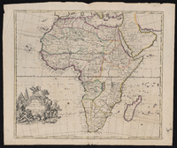 [Untitled]
 Relief depicted pictorially., "Most humbly inscrib'd to [th]e most Honoble the Marquis of Annandale & Kt. of the most noble & ancient Order of the Thistle."
-
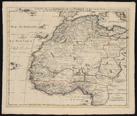 [Untitled]
 Relief shown pictorially.
Prime meridian: Ferro.
-
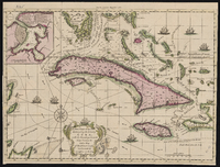 [Untitled]
 Relief shown pictorially.
Depths shown by soundings.
In upper margin: For the London magazine 1762., Includes indexed inset of "A plan of the harbour & town of Havana" and ill.
-
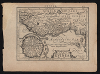 [Untitled]
 After a map by Blaeu. Blank on verso, with no imprint and without a dedication.
Possibly issued by Frederick de Wit as part of a composite atlas, approximately 1680.,
Title within cartouche depicting African men, monkeys, and a parrot. At right two winged putti carry an elephant tusk.
Illustrated with sailing ships, lions, leopards, monkeys, and elephants.
Relief shown pictorially.
-
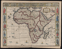 [Untitled]
 Relief represented pictorially., "Abraham Goos sculpsit."
Insets (3 x 6 cm each) at tope: Tanger -- Ceuta -- Alger -- Tunis -- Alexandria -- Alcair -- Mozambique -- Canaria.
Ten illustrations of African people at left and right. Also included are illustrations of animals, birds, sea monsters, ships and historical notes.
Letterpress text on verso (p. 5-6) under title: The description of Africa.
-
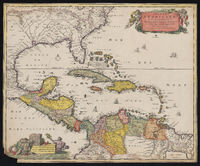 [Untitled]
 Letterpress text in Latin on verso, with running title "Hispaniola & Cuba", and caption title "Insulae Americae praecipuae sunt Hispaniola et Cuba". No signature beneath text.
-
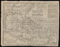 [Untitled]
 Relief shown pictorially.
West Indies map with southern United States, Central America and northern South America showing landforms, drainage, cities, prevailing winds, historical notes, explanatory text, and other landmarks.
Title in box at top middle., "Emanl. Bowen, sculpt."
Scale statement adjacent to right latitude lines.
Prime meridian: London.
Geographic coordinates converted to Greenwich.,
Originally published in Cave's first edition geography text.
Below imprint is text advertising Cave's publication, Geography reformed; or a new system of general geography., Detached from: Gentleman's Magazine, vol. 10.
Map listed in contents page for Jan. 1740 edition. One of the historical notes refers to Gentleman's Magazine for reference.
-
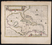 [Untitled]
 Relief shown pictorially. Shows southeastern North America as Florida with colony of Virginia, Pacific and Gulf coasts of Central America, northern coast of South America, and the West Indies., Includes illustrations.
From Visscher's Atlas minor., "For the French names on the Florida coast Visscher appears to have based his map on Mercator's Virginiae item et Floridae ... nova descriptio 1606.
The plate appears to be the same used with the same title by Janssón, 1642; Guilielmus Blaeu, 1644; Johannis Blaeu, 1667; Valck and Schenk, 1710 (?")--cf. Philip Lee Phillips.
-
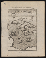 [Untitled]
 Bird's-eye view, illustrated with sailing ships., Relief show pictorially.
-
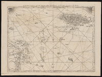 [Untitled]
 Relief is shown by hachures, depths shown by soundings and shading.
Prime meridians: Ferro and London.
-
 [Untitled]
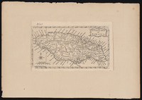
 Horizontal bar scale given in English miles.
-
 [Untitled]
-
 [Untitled]
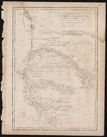
 Depths shown in soundings
-
 [Untitled]
-
 [Untitled]
 Relief shown pictorially.
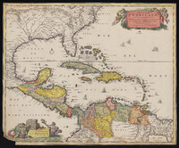
Shows southeastern North America as Florida with colony of Virginia, Pacific and Gulf coasts of Central America, northern coast of South America, and the West Indies.
Includes illustrations.
"For the French names on the Florida coast Visscher appears to have based his map on Mercator's Virginiae item et Floridae ... nova descriptio 1606. The plate appears to be the same used with the same title by Janssón, 1642; Guilielmus Blaeu, 1644; Johannis Blaeu, 1667; Valck and Schenk, 1710 (?")--cf. Philip Lee Phillips.
 [Untitled] A hand-drawn map for publication. Includes Suez at the top and Yambo at the bottom. Emphasis on ports and coastal spaces with suggestion of hills and mountains. Map designed to be folded.
 [Untitled]
 [Untitled]
 [Untitled]
 [Untitled]
 [Untitled]
 [Untitled] Relief depicted pictorially., "Most humbly inscrib'd to [th]e most Honoble the Marquis of Annandale & Kt. of the most noble & ancient Order of the Thistle."
 [Untitled] Relief shown pictorially. Prime meridian: Ferro.
 [Untitled] Relief shown pictorially. Depths shown by soundings. In upper margin: For the London magazine 1762., Includes indexed inset of "A plan of the harbour & town of Havana" and ill.
 [Untitled] After a map by Blaeu. Blank on verso, with no imprint and without a dedication. Possibly issued by Frederick de Wit as part of a composite atlas, approximately 1680., Title within cartouche depicting African men, monkeys, and a parrot. At right two winged putti carry an elephant tusk. Illustrated with sailing ships, lions, leopards, monkeys, and elephants. Relief shown pictorially.
 [Untitled] Relief represented pictorially., "Abraham Goos sculpsit." Insets (3 x 6 cm each) at tope: Tanger -- Ceuta -- Alger -- Tunis -- Alexandria -- Alcair -- Mozambique -- Canaria. Ten illustrations of African people at left and right. Also included are illustrations of animals, birds, sea monsters, ships and historical notes. Letterpress text on verso (p. 5-6) under title: The description of Africa.
 [Untitled] Letterpress text in Latin on verso, with running title "Hispaniola & Cuba", and caption title "Insulae Americae praecipuae sunt Hispaniola et Cuba". No signature beneath text.
 [Untitled] Relief shown pictorially. West Indies map with southern United States, Central America and northern South America showing landforms, drainage, cities, prevailing winds, historical notes, explanatory text, and other landmarks. Title in box at top middle., "Emanl. Bowen, sculpt." Scale statement adjacent to right latitude lines. Prime meridian: London. Geographic coordinates converted to Greenwich., Originally published in Cave's first edition geography text. Below imprint is text advertising Cave's publication, Geography reformed; or a new system of general geography., Detached from: Gentleman's Magazine, vol. 10. Map listed in contents page for Jan. 1740 edition. One of the historical notes refers to Gentleman's Magazine for reference.
 [Untitled] Relief shown pictorially. Shows southeastern North America as Florida with colony of Virginia, Pacific and Gulf coasts of Central America, northern coast of South America, and the West Indies., Includes illustrations. From Visscher's Atlas minor., "For the French names on the Florida coast Visscher appears to have based his map on Mercator's Virginiae item et Floridae ... nova descriptio 1606. The plate appears to be the same used with the same title by Janssón, 1642; Guilielmus Blaeu, 1644; Johannis Blaeu, 1667; Valck and Schenk, 1710 (?")--cf. Philip Lee Phillips.
 [Untitled] Bird's-eye view, illustrated with sailing ships., Relief show pictorially.
 [Untitled] Relief is shown by hachures, depths shown by soundings and shading. Prime meridians: Ferro and London.
 [Untitled] Horizontal bar scale given in English miles.
 [Untitled]
 [Untitled] Depths shown in soundings
 [Untitled]
 [Untitled] Relief shown pictorially. Shows southeastern North America as Florida with colony of Virginia, Pacific and Gulf coasts of Central America, northern coast of South America, and the West Indies. Includes illustrations. "For the French names on the Florida coast Visscher appears to have based his map on Mercator's Virginiae item et Floridae ... nova descriptio 1606. The plate appears to be the same used with the same title by Janssón, 1642; Guilielmus Blaeu, 1644; Johannis Blaeu, 1667; Valck and Schenk, 1710 (?")--cf. Philip Lee Phillips.