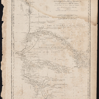
Particular Map of the Western Coast of Africa from Cape Blanco to Cape De Verga and of the Course of the Rivers Senega and Gambia
Item
-
Description
-
Depths shown in soundings
-
Relief shown pictorially
-
Prime meridian: Ferro
-
Horizontal bar scales in French leagues, marine leagues, and British statute miles
-
Date Published
-
1788
-
Publisher
-
London
-
Engraved for Jn. Harrison, no. 115 Newgate Street
-
Subject
-
18th century
-
Early works to 1800
-
Gambia
-
Maps
-
Nautical charts
-
Rivers
-
Senegal
-
Gambia
-
Atlantic Coast of Africa
-
Africa
-
Type
-
Map
-
Language
-
English
-
Format
-
Digital facsimile
-
Short Title
-
Particular Map of the Western Coast of Africa
-
Source
-
From D'Anville's Atlas containing a map of the world, the world in twelve maps and twelve maps of the most interesting parts of the world upon a large scale (London, 1792), plate 36.
-
Rights
-
Public Domain
-
Public Domain
-
Spatial Coverage
-
Africa
-
The Gambia
-
Senegal
-
Provenance
-
John J. Burns Library at Boston College